Makeup
Farmer Accidentally Discovers Ancient Roman Fort in His Field
Jun
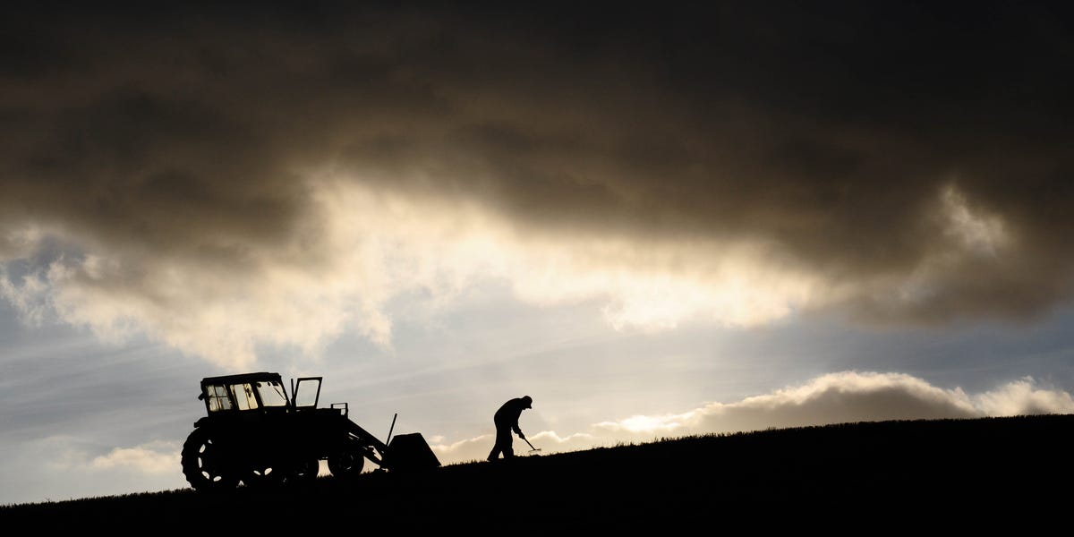
Every farmer expects a few surprises in a field: stubborn weeds, broken tools, suspiciously judgmental crows. What most farmers do not expect is to learn that the reason the plow keeps striking slate and stone may be because an ancient Roman fort has been quietly napping beneath the grass for nearly 2,000 years.
That is the wonderfully strange heart of the story behind the ancient Roman fort discovered in Pembrokeshire, Wales. The popular version sounds like a movie trailer: a farmer accidentally discovers an ancient Roman fort in his field. The fuller story is even better. A local farmer had long known the land was difficult to work because of buried stone. Then Dr. Mark Merrony, a Roman specialist associated with Wolfson College, Oxford, investigated the area after noticing suspiciously Roman-looking clues in the landscape and satellite imagery. Soon, a troublesome field began looking less like bad farmland and more like a major archaeological discovery.
The result is a find that could reshape how historians understand Roman military power in west Wales, especially the relationship between Rome and the Celtic Demetae tribe. In other words, the field did not merely contain old stones. It contained a plot twist.
A Field That Refused to Behave
The farmer’s field in Pembrokeshire had a practical problem: it was full of slate and stone. For agriculture, that is annoying. For archaeology, it is the land waving both arms and shouting, “Excuse me, I have a secret.” The stones were not random rubble from a forgotten shed or a medieval wall that had lost its ambition. They appeared to include Roman roofing slates, the kind of diagnostic material that can help archaeologists identify Romano-British buildings.
Dr. Merrony had already been studying Roman roads in the region. A particularly straight road caught his attention, as Roman roads have a famous habit of ignoring scenery and marching across the landscape with the confidence of a ruler, a surveyor, and a very impatient delivery driver. When he looked at satellite imagery, he noticed a rectangular shape with rounded corners beneath overgrowth. That “playing-card” shape is one of the classic calling cards of Roman military design.
When he visited the site, the clues became harder to dismiss. A triangular piece of slate emerged from the ground, and its shape, grooves, and working marks suggested Roman roofing material. The field that had irritated farming equipment was beginning to look like a buried auxiliary fort.
Why the Roman Fort Discovery Matters
This was not just another old structure under a field. The suspected fort is believed to date from roughly the first to third centuries AD, a period when Rome was consolidating and controlling its province of Britannia. The site has been described as large enough to house a unit of around 500 soldiers, which would make it a significant military installation rather than a tiny outpost with delusions of grandeur.
The discovery matters because Pembrokeshire had often been viewed as less heavily militarized than other parts of Roman Wales. The local Celtic tribe, the Demetae, has sometimes been interpreted as comparatively friendly or cooperative toward Rome. A large fort in the region complicates that tidy picture. If Rome built a substantial military base there, it may indicate a stronger need for control, surveillance, logistics, and perhaps pressure on the local population.
History enjoys ruining simple stories. We like to imagine ancient regions as neatly divided between “peaceful allies” and “fierce rebels,” but real life is messier. A Roman fort in Pembrokeshire suggests that the area may have been more strategically important, more contested, or more deeply integrated into Roman military planning than previously believed.
The Shape of a Roman Military Machine
Roman forts were not built casually. The Roman army loved order the way a librarian loves labels. A typical auxiliary fort often had straight sides, rounded corners, defensive ditches, ramparts, internal roads, barracks, administrative buildings, storage areas, and gates placed according to military logic. The Pembrokeshire site reportedly shows several of these classic features: a rectangular outline, rounded corners, banks, ditches, and a strategic position overlooking a river valley.
The fort’s approximate footprint has been reported at about 185 by 155 meters. That is large enough to transform the interpretation of the landscape around it. A fort of this type would not exist in isolation. Roman soldiers needed food, water, roads, storage, workshops, animals, supplies, and a steady flow of orders. Where soldiers went, infrastructure followed. And where infrastructure followed, local life changed.
Archaeologists also suspect there may have been an associated vicus, or civilian settlement, near the fort. A vicus often developed beside Roman military sites, bringing traders, families, craftspeople, and service providers into the orbit of the army. Think of it as the ancient version of a military-adjacent town, minus the coffee chains and plus a lot more pottery.
Roman Roads: The Ancient Internet of Empire
One of the most exciting parts of the Pembrokeshire discovery is its connection to a possible Roman road. Roman roads were the empire’s circulatory system. They moved troops, messages, taxes, livestock, building materials, and authority. If a fort sat beside a road, it was not randomly placed. It was plugged into a larger network.
For years, scholars have debated how deeply the Romans penetrated west Wales and how organized their presence was. Discoveries like this fort and the previously investigated Roman fort at Wiston suggest the region may have had a more developed Roman military network than older assumptions allowed.
The Wiston fort is especially important for comparison. It was investigated through LiDAR, geophysical survey, and excavation, and it helped prove that the far west of Wales was not beyond meaningful Roman military reach. The new Pembrokeshire fort may add another key point to that map, turning what looked like isolated evidence into a broader pattern.
How Technology Helped Reveal the Past
Modern archaeology is not just about trowels, brushes, and people in wide-brimmed hats looking thoughtfully at dirt. Today, researchers use satellite imagery, LiDAR, magnetometry, resistivity, drone photography, old maps, fieldwalking, and geophysical survey. The Pembrokeshire discovery shows how these tools work together with local knowledge.
The farmer knew the field was full of stone. Dr. Merrony knew what Roman features might look like. Satellite imagery revealed a suspicious shape. Field inspection produced diagnostic slate. Later geophysical work reportedly detected features such as ditches, pits, post-holes, possible foundations, platforms, and a water-related channel entering the site. Each clue strengthened the case.
This is why archaeology often feels like detective work, except the witnesses are hedgerows, soil marks, stones, and extremely old roof fragments. No single clue usually solves the mystery. The story emerges when many small details begin pointing in the same direction.
The Farmer’s Role in an Archaeological Surprise
The headline “farmer accidentally discovers ancient Roman fort in his field” captures the charm of the story, but the real hero is shared curiosity. The farmer noticed the land’s unusual behavior because he worked it. Without that practical relationship with the field, the buried stone might have remained just another nuisance. Farmers, builders, hikers, metal detectorists, and local residents often become the first people to notice when the ground is trying to confess something.
That does not mean every awkward rock is a Roman barracks. Sometimes a rock is just a rock with excellent self-esteem. But when unusual materials appear repeatedly, especially cut stone, tile, pottery, worked slate, metal objects, or patterned earthworks, they deserve attention.
The best archaeological discoveries often happen when everyday observation meets professional caution. The farmer had the experience of the land. The archaeologist had the training to interpret it. Together, they helped reveal a hidden chapter of Roman Britain.
What the Fort Suggests About Rome and the Demetae
The Demetae occupied the south-western area of modern Wales during the Roman period. Compared with some other groups in Wales, they have often been viewed as less violently opposed to Roman rule. But a substantial fort changes the conversation. Large military structures are expensive. Rome did not build them for decoration, nostalgia, or because a centurion needed a weekend project.
If the fort housed hundreds of soldiers, it may suggest that Rome considered the area strategically sensitive. The fort could have helped control movement through the landscape, secure road routes, protect supply lines, supervise local populations, or support military operations deeper in the region. It may also have served as a visible reminder that Roman authority had arrived wearing sandals, armor, and a very serious expression.
This does not prove constant conflict. Archaeology rarely hands us a tidy note saying, “Dear future scholars, here is exactly what happened.” But it does challenge any overly peaceful interpretation of Roman-Demetae relations. The evidence points toward a more militarized west Wales than many readers may have imagined.
Why the Exact Location Is Being Protected
The precise location of the site has not been widely disclosed, and that is a good thing. Important archaeological sites can be damaged by looting, illegal digging, souvenir hunting, and even well-meaning curiosity. A buried fort is not a treasure chest. It is a fragile archive.
Objects lose much of their meaning when removed without proper recording. A coin, nail, pottery sherd, or roof slate can tell archaeologists where a building stood, how a room was used, when a site was occupied, and how people moved through it. Pulling artifacts out of context is like tearing random pages from a rare book and then wondering why the plot makes no sense.
Protecting the site allows professionals to conduct surveys, map features, evaluate preservation, and decide whether formal heritage protection is needed. It also gives local communities the chance to benefit from the discovery through education, research, and responsible heritage tourism in the future.
Accidental Discoveries Are More Common Than You Think
One reason this story has captured public imagination is that it feels possible. Not likely, perhaps, but possible. Fields, gardens, construction sites, riverbanks, and footpaths have all produced major archaeological finds. Human beings have been dropping, burying, building, losing, burning, repairing, and abandoning things for thousands of years. The ground is basically history’s junk drawer.
Across Britain and Europe, accidental discoveries have revealed Roman villas, mosaics, roads, coins, forts, burials, and tools. Some were found by archaeologists using advanced technology. Others were noticed by landowners, workers, or ordinary people who saw something that did not look quite right. In many cases, the crucial first step was not expertise. It was curiosity.
The Pembrokeshire Roman fort reminds us that landscapes are layered. A quiet field may have once been a military base. A hedgerow may preserve the line of an ancient boundary. A straight road may follow the bones of a Roman route. The modern countryside is not empty space; it is a palimpsest, with one age written over another.
What to Do If You Find Something Ancient
If you ever discover something that looks archaeological, resist the urge to become Indiana Jones with a garden spade. Take a breath. Photograph the object where it lies. Note the location. Do not clean, scrape, polish, or remove more material than necessary. If the find is on private land, make sure the landowner is involved. Then contact the appropriate local heritage authority, museum, archaeological trust, or finds reporting program.
Context is everything. A single Roman nail may not look glamorous, but if found in the right place, it can help identify a building. A piece of pottery may help date a ditch. A roofing slate may confirm the presence of a Roman structure. The object matters, but its relationship to the soil, nearby features, and surrounding landscape matters just as much.
Also, do not post exact coordinates online. The internet is wonderful for cat videos and deeply questionable for protecting archaeological sites. Public excitement should never become an invitation to damage the past.
Experience Section: Lessons From a Field That Hid a Fort
The story of the farmer and the Roman fort offers several useful experiences for anyone interested in history, land, farming, or local discovery. The first lesson is that inconvenience can be information. A field that keeps producing stone may be more than a difficult field. A strange ridge, an oddly straight lane, a recurring scatter of pottery, or a patch of land that behaves differently from the rest may be a clue. In archaeology, the annoying detail is often the doorway.
The second lesson is to respect local knowledge. Farmers, gardeners, walkers, and rural families often notice patterns long before academics arrive. They know where the ground stays wet, where plows catch, where old walls seem to run, and where unusual fragments appear after rain. That kind of knowledge is not a substitute for archaeological method, but it is incredibly valuable. The best discoveries happen when lived experience and professional research listen to each other.
The third lesson is that patience protects history. When people find something old, excitement can run ahead of good judgment. It is tempting to dig deeper, pull harder, or show everyone online. But archaeology rewards restraint. The Pembrokeshire fort may have survived because the land was not heavily disturbed. That preservation gives researchers a better chance of understanding the full site, not just collecting attractive objects.
The fourth lesson is that technology works best when guided by human curiosity. Satellite imagery and geophysical survey did not randomly announce, “Congratulations, you have unlocked a Roman fort.” A researcher had to notice a straight road, compare shapes, understand Roman design, visit the site, and recognize worked slate. Tools are powerful, but interpretation still belongs to people.
The fifth lesson is that history is not finished. Schoolbooks can make the past feel settled, as if every Roman road, fort, and settlement has already been found and labeled. The Pembrokeshire discovery proves otherwise. Even in well-studied regions, major evidence can remain hidden beneath grass, hedges, and ordinary fields. The map of Roman Britain is still being revised, one clue at a time.
Finally, this story teaches humility. A farmer may see a bad field. An archaeologist may see a fort. A historian may see a challenge to old assumptions. A local community may see a new connection to its deep past. The same patch of ground can mean different things depending on who is looking. That is the magic of archaeology: it turns familiar places into mysteries and reminds us that the past is not gone. Sometimes it is just under the next layer of soil, waiting for someone to notice that the stones are trying to say something.
Conclusion: When Ordinary Land Becomes Extraordinary
The accidental discovery of an ancient Roman fort in a farmer’s field is more than a charming headline. It is a reminder that history is not confined to museums, textbooks, or carefully fenced ruins. Sometimes it is buried under a field that refuses to cooperate with a plow.
The Pembrokeshire fort may help rewrite the story of Roman west Wales. It suggests that the region was more militarized, more connected, and more strategically important than once believed. It also shows how modern archaeology depends on a blend of technology, expertise, local observation, and respect for preservation.
Most of all, the story invites us to look again at ordinary landscapes. A field may be a field. Or it may be a Roman military base that has been keeping a very long, very stony secret.
Note: This article does not disclose exact site-location details because responsible archaeology protects vulnerable remains from looting, disturbance, and loss of historical context.
